With the resource of Western Illinois University in our backyard, we are very fortunate to be able to share maps that Western Illinois University GIS Center has completed. Two of these maps include very comprehensive maps of local cemeteries, headstones, and owners of plots.
Oakwood Cemetery, Macomb, McDonough County, Illinois
Good Hope Cemetery, Good Hope, McDonough County, Illinois
Former WIU Graduate Student and Macomb native, Zach Sutton [BA 2020, MS 2022] completed a digital reconstruction of Historic Downtown Macomb while completing his Master’s degree work. This interactive map lets you ‘time travel’ back as far as 1920 Macomb to see what businesses occupied buildings on and near the Macomb square. The map progresses roughly every decade for over 100 years. Digital Reconstruction of Historic Downtown Macomb If you have photos of the historic downtown Macomb square sometime between 1920 and 2021, and you are willing to share them with Zach for this project, please email them to him at historicmacombillinoismap@gmail.com.
Have you ever used Sanborn maps to look up your ancestors?
“The Sanborn map collection consists of a uniform series of large-scale maps, dating from 1867 to the present and depicting the commercial, industrial, and residential sections of some twelve thousand cities and towns in the United States, Canada, and Mexico.”
Library of Congress
Sanborn maps identify streets, structures, businesses, homes, churches, schools, and other insurable buildings within a community. They are free to use and downloadable. Click here for a link to Sanborn maps at the Library of Congress.
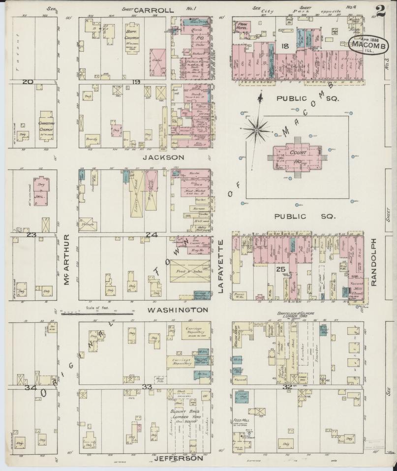
dimensions and building materials for structures that were insurable.